
Posted in

Tboung Khmum: Cambodia’s Quiet Red-Earth Heartland, Cradle of the Memotian Culture

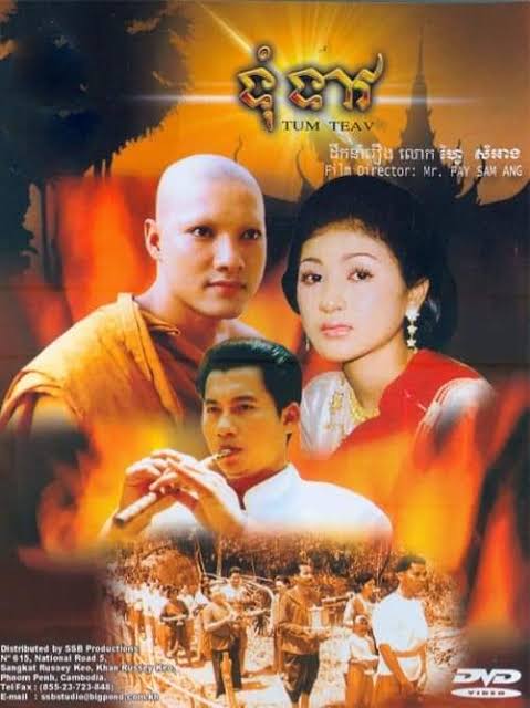
Listen to a song about two lovers from Tboung Khmum province who wish their love to be prosperous and it will not end up in tragedy the like of Tum and Teav’s.

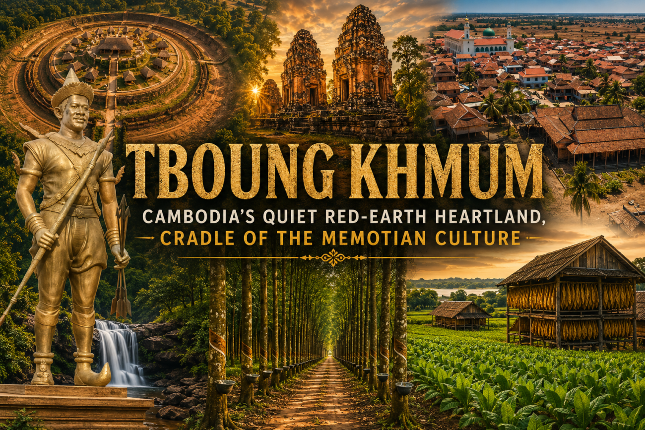
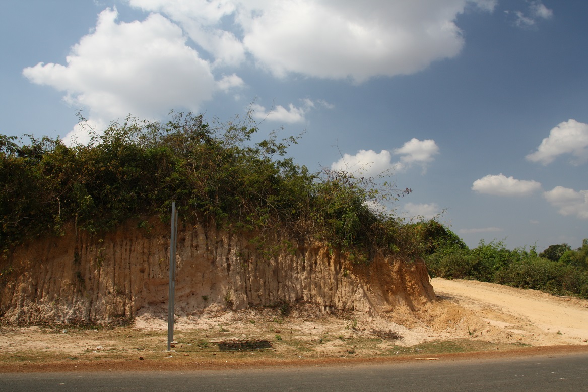
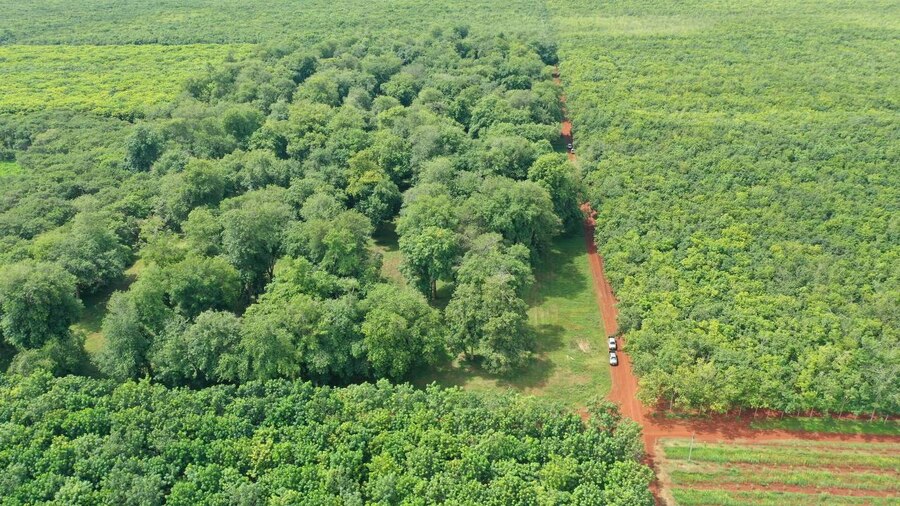
There is a quiet transformation that happens when you enter eastern Cambodia. The busy roads of Kampong Cham slowly disappear behind you. The scenery widens into endless farmland. Dust rises from red-earth roads. Rubber trees stretch toward the horizon in perfect rows, while tobacco barns stand beside the Mekong River like weathered wooden cathedrals.

This is Tboung Khmum Province – one of Cambodia’s newest provinces administratively, yet one of its oldest cultural landscapes. Officially established in 2013 after separating from Kampong Cham Province, Tboung Khmum is often overlooked by international travelers. Most visitors crossing eastern Cambodia continue directly toward Vietnam or return west toward Angkor. Few realize that this quiet province contains some of the deepest historical layers in the country – layers that, in truth, predate the province’s modern paperwork by thousands of years.

The Ancient Origins of Tboung Khmum

Cambodia Long Before Angkor

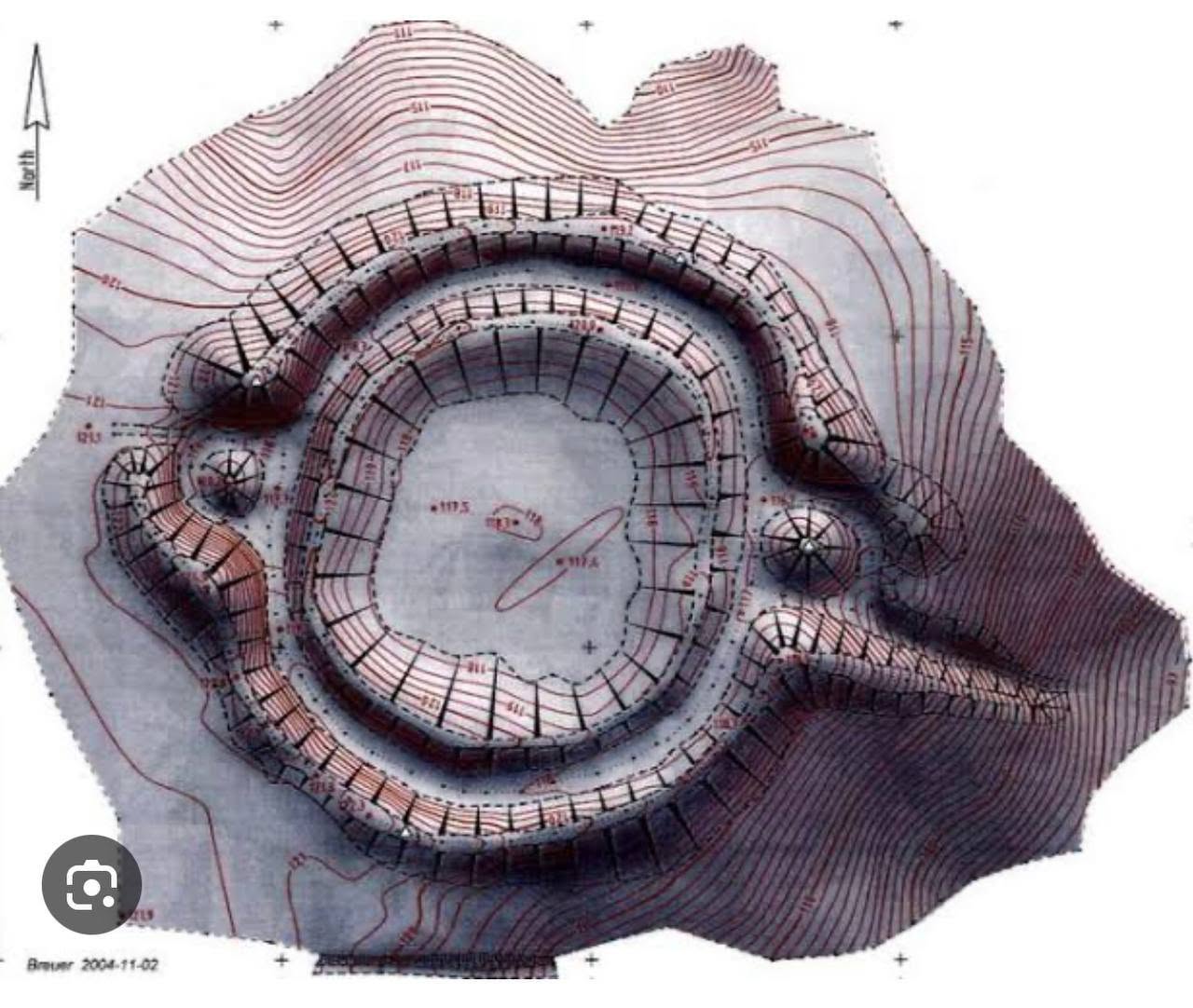
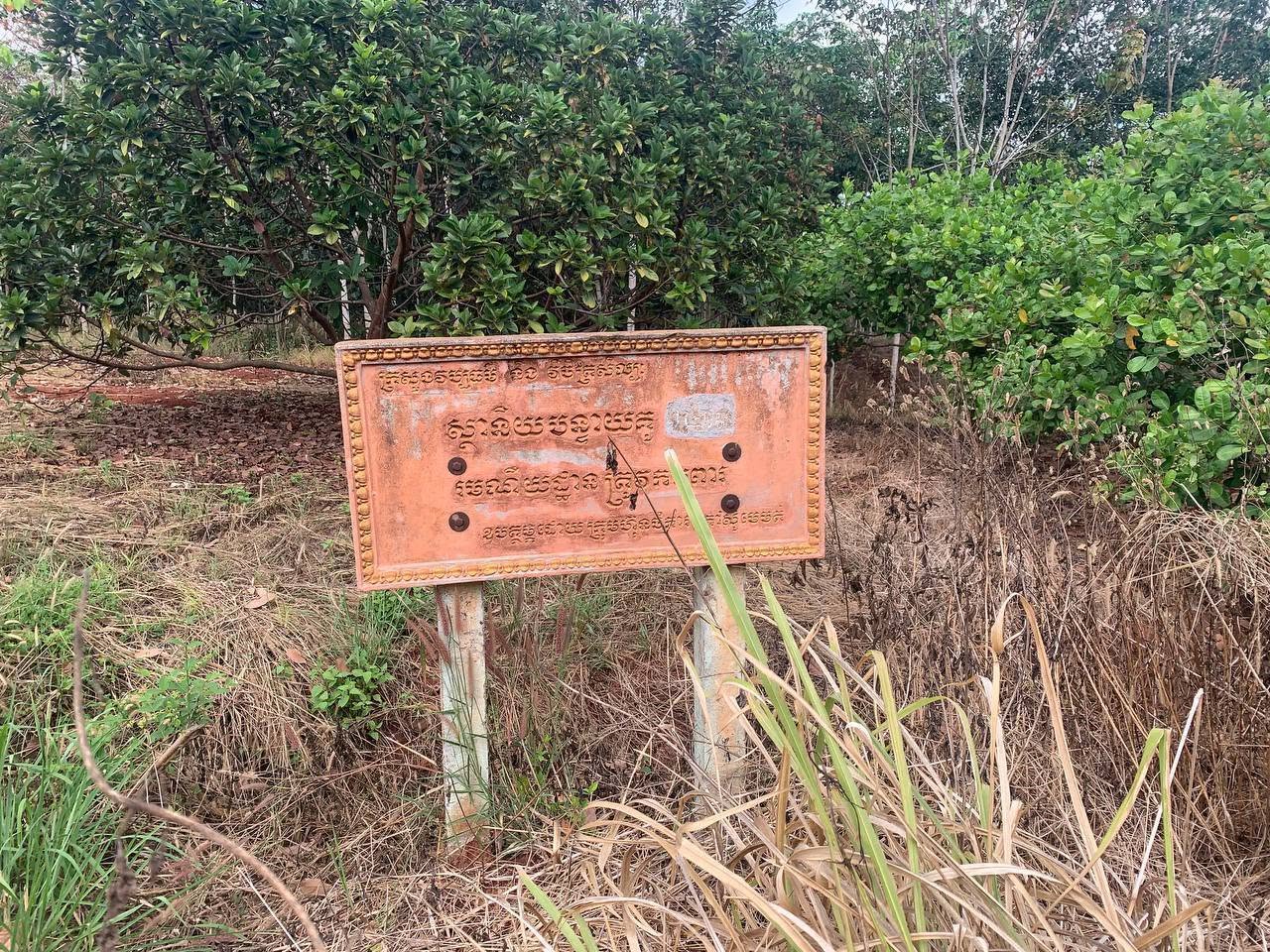
In the Memot region of eastern Cambodia, archaeologists discovered one of mainland Southeast Asia’s most important prehistoric landscapes: the circular earthworks associated with the “Memotian Culture”. Among the most significant of these sites are the circular earthworks known locally as Banteay Kou (បន្ទាយគូ) or Phum Mool (ភូមិមូល / round village) – a term that refers not to one single site, but to an entire class of them scattered across the province.

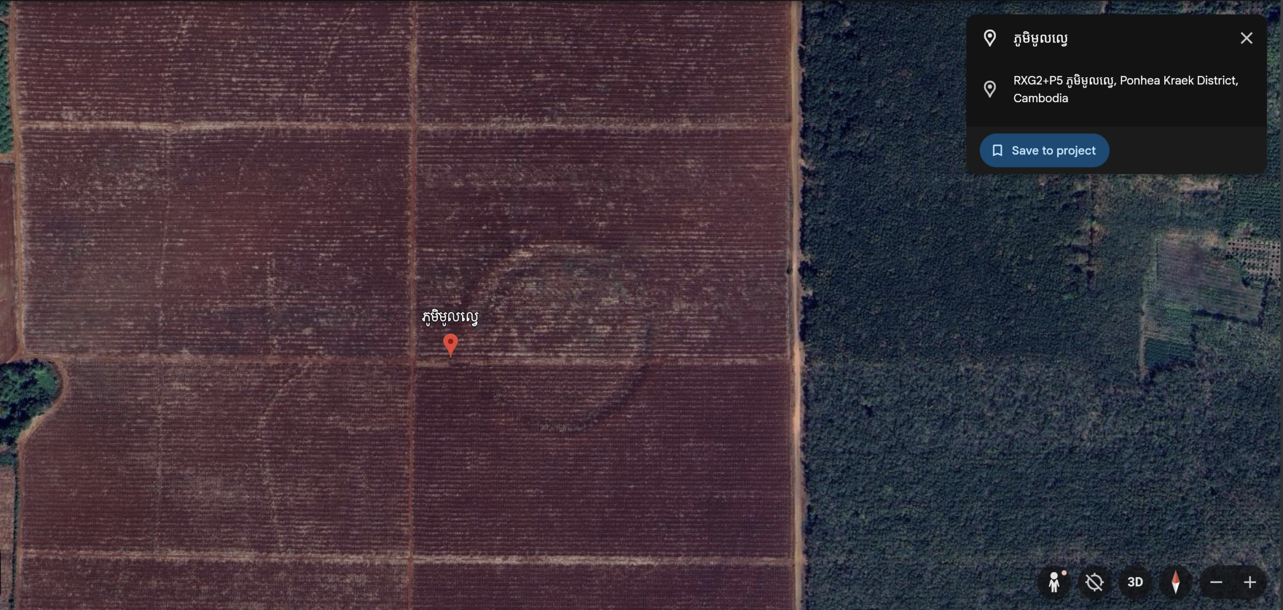
Seen from above, each of these round villages appears as a massive circular settlement carved into the red earth. The sites typically contain a raised central habitation area surrounded by large earthen embankments and interior trenches. Archaeologists believe these settlements date roughly between 2300 BC and 300 BC, spanning the late Neolithic and Early Iron Age periods of Southeast Asia. At least 36 similar circular earthworks have been documented across eastern Cambodia and neighboring Vietnam. What makes these sites extraordinary is their scale and planning. Many measure between 100 and 400 meters in diameter, with carefully designed openings aligned toward nearby water sources. Even thousands of years ago, the communities living here already demonstrated sophisticated environmental knowledge and settlement organization.

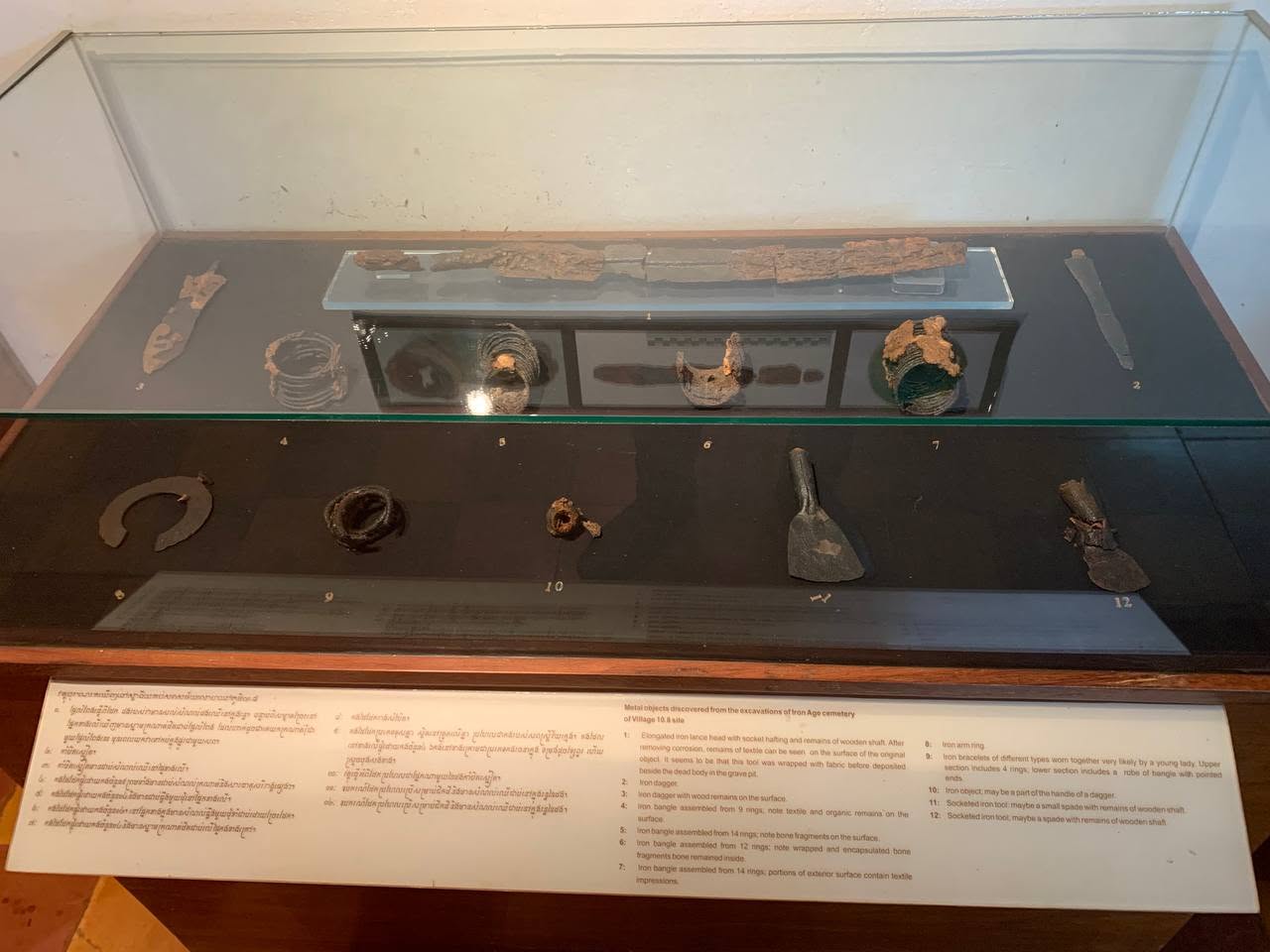
Excavations in the Memot region have uncovered polished stone axes used for clearing forests, ceramic cooking vessels, decorative pottery pedestals, spindle whorls used in weaving, and ornamental objects crafted from stone and clay. Archaeologists have also discovered glass bangles and agate beads linked to early trade networks, suggesting these communities were already connected to wider regional exchange systems.

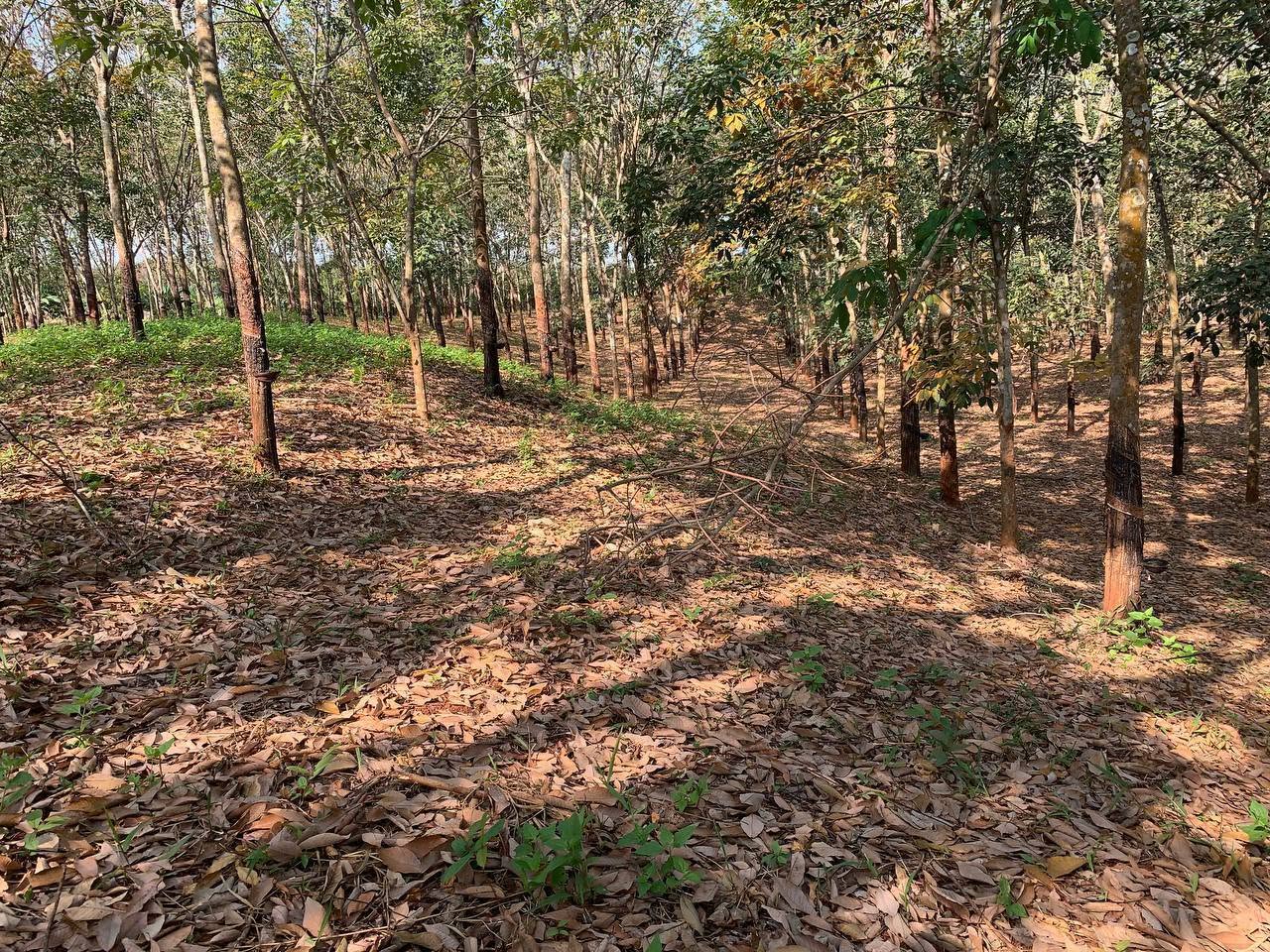
Unfortunately, many of these ancient earthworks now lie hidden within private rubber and cashew plantations. Agricultural expansion and erosion continue to threaten several archaeological sites, while public access remains limited. Most of the sites are also mapped only approximately, to the district or village level, so visitors hoping to see one in person are generally advised to arrange a local guide from the area rather than attempt to find them independently.

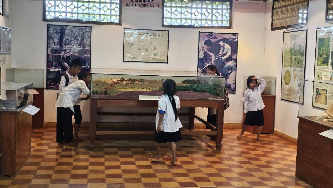
For now, much of this prehistoric heritage remains unknown to international tourism despite its immense historical significance – though the artifacts recovered from these earthworks, including the stone tools, pottery, and jewelry mentioned above, can be seen up close at the Memot Centre for Archaeology and Museum.

The Birthplace of Early Khmer Civilization

Before the Khmer Empire

Centuries before Angkor emerged in northwestern Cambodia, eastern Cambodia already held political and spiritual importance. During the Funan and Chenla periods between the 6th and 9th centuries, the region that is now Tboung Khmum became home to some of the earliest Khmer religious centers. These early kingdoms laid the foundations for the Khmer Empire that would later dominate much of mainland Southeast Asia.

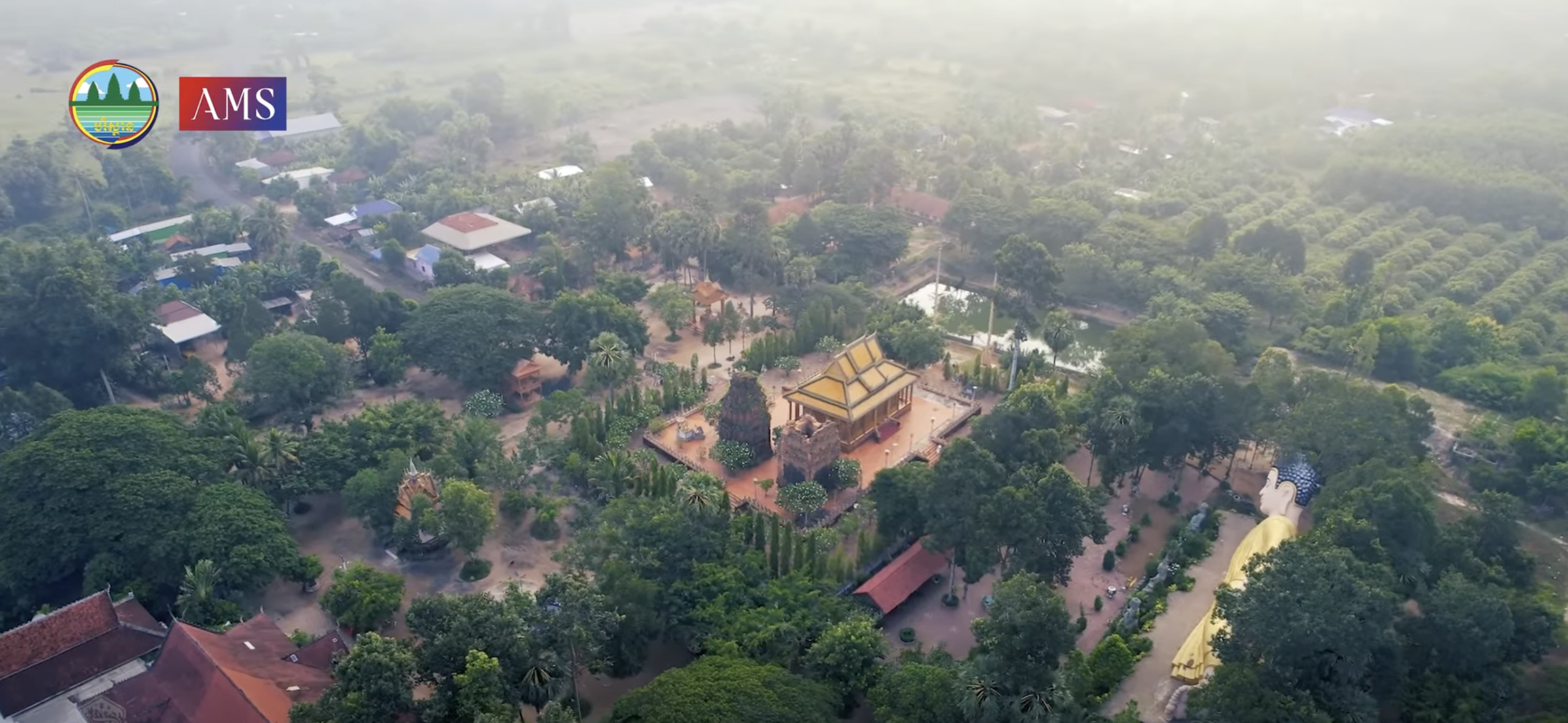
Preah Theat Ba Srei: one of the province’s oldest sacred sites

Dating to approximately the 6th century, the temple is associated with the Chenla Kingdom and King Isanavarman I. Ancient inscriptions describe royal offerings made to the sanctuary, including land, livestock, and servants.

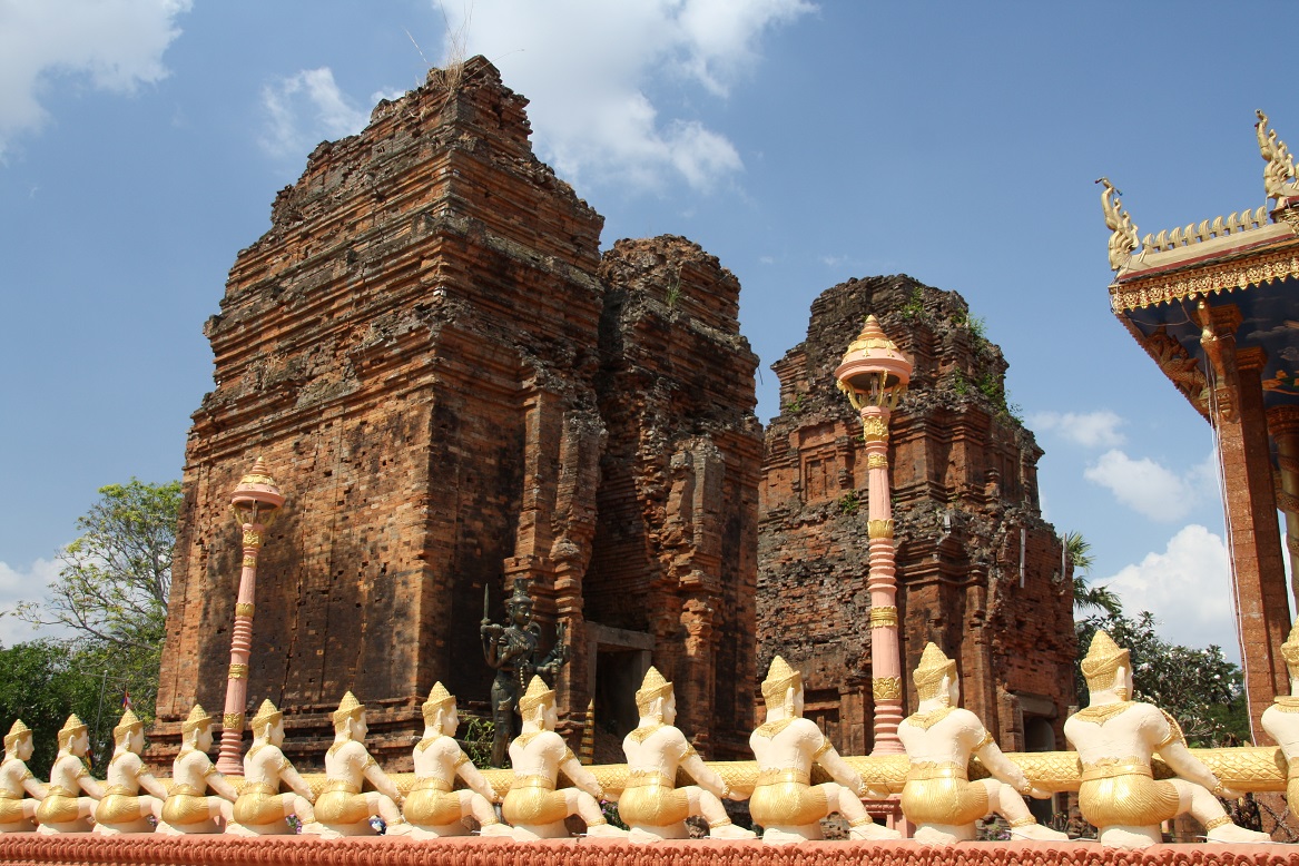
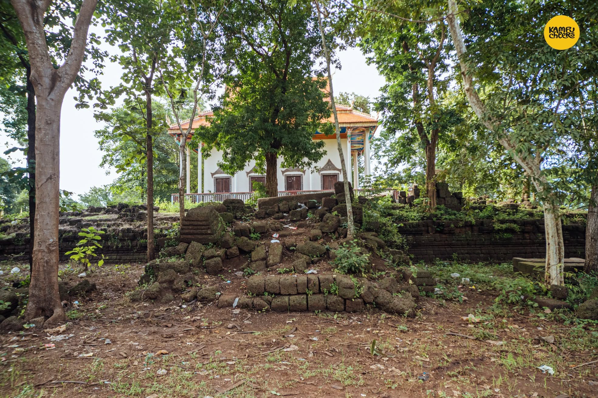
Today, the site remains spiritually active. Ancient laterite ruins stand beside a more modern pagoda built directly beside them, creating a visible connection between Cambodia’s ancient and contemporary religious traditions. The site is quiet and serene, offering a genuine window into the pre-Angkorian civilization that once thrived in this region – for history-minded travelers, it is one of the province’s true must-visits.

Prasat Preah Theat Thom, Prasat Prey Key, Prasat Cheung Ang

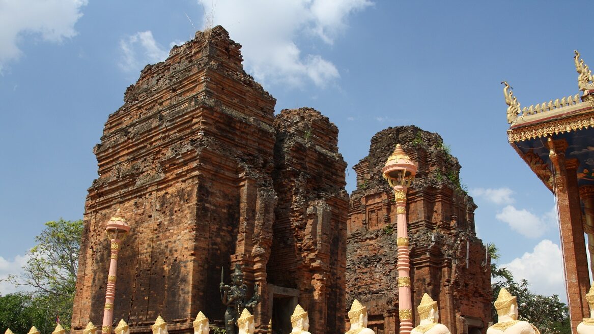
Another important site is Preah Theat Thom. Its southern tower is believed to date to the reign of King Bhavavarman I during the 7th century, while later additions are associated with King Jayavarman II in the late 8th century. This connection carries enormous historical importance. Jayavarman II is widely regarded as the founder of the Khmer Empire – the ruler who later declared himself universal monarch on Phnom Kulen in 802 AD.

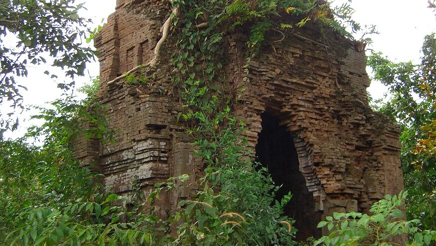
Before Angkor existed, however, eastern Cambodia likely formed part of his early political landscape. This means Tboung Khmum is not simply a rural agricultural province. It is part of the birthplace of Khmer civilization itself. Elsewhere in the province, smaller pre-Angkorian sanctuaries such as Prasat Prey Ky and Prasat Cheung Ang preserve remarkable examples of this same early Khmer brick architecture – foundations laid centuries before Tboung Khmum’s later fame as the refuge of the deposed king Sdach Kân.

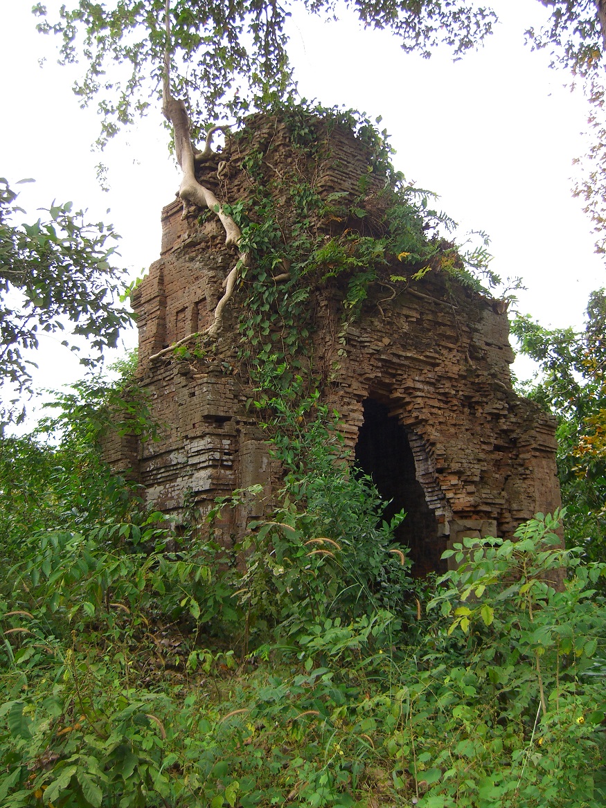
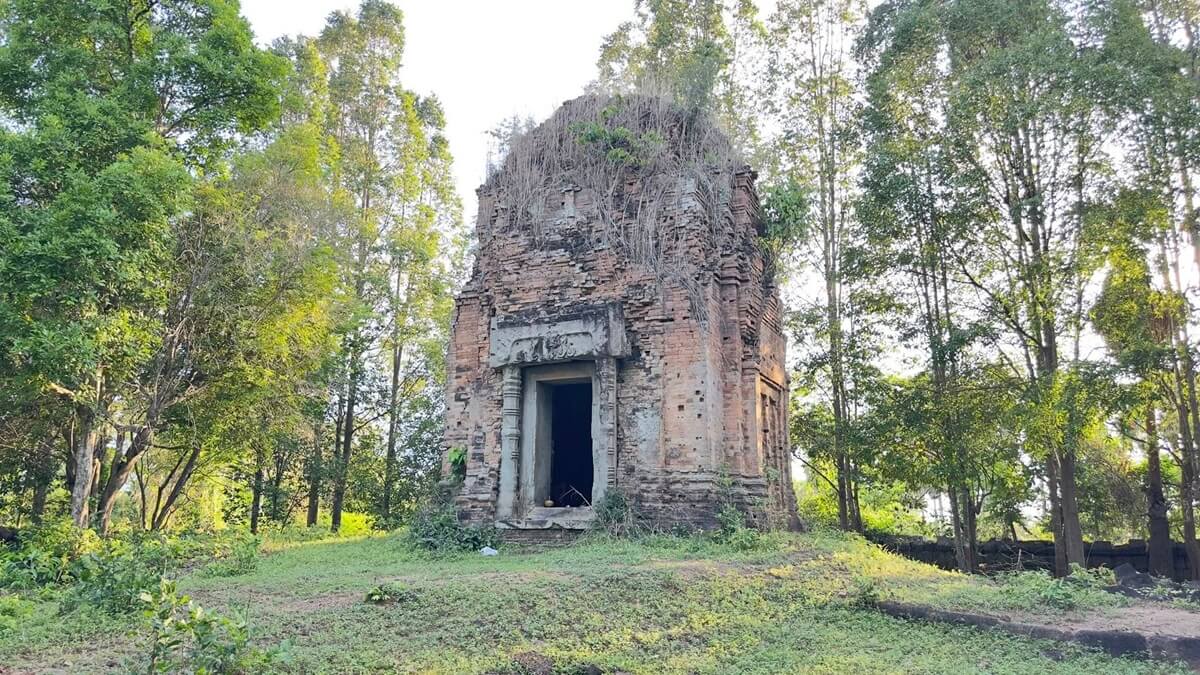
Prasat Preah Theat Thom
Prasat Prei Ky
Prasat Cheung Ang

The Forgotten Capital of Cambodia

Banteay Prey Nokor and King Sdach Kan

As the Angkor Empire declined between the 15th and 16th centuries, Cambodia entered a turbulent era marked by political instability, shifting capitals, and foreign invasions. During this period, Tboung Khmum once again rose to importance. The province became closely linked to the legendary figure of Preah Sdach Kan (ស្ដេចកន) – also recorded in Khmer chronicles as Srei Chettha II, a commoner who rose to power and briefly seized the Cambodian throne, ruling from around 1512 to 1521 before dethroning the reigning king and attempting to establish his own dynasty.

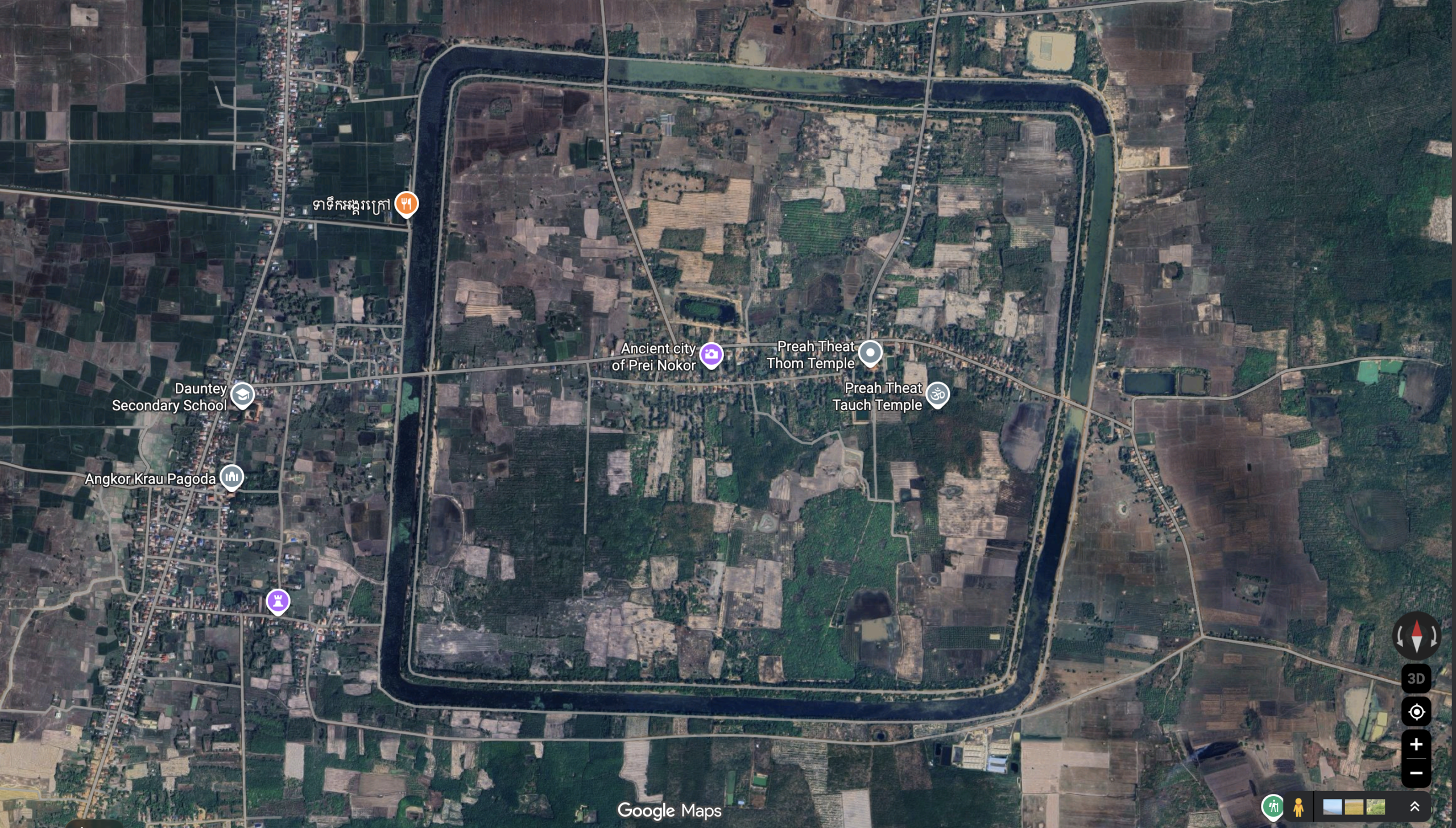
His legacy survives through the historic site of Banteay Prey Nokor. Yet Banteay Prey Nokor’s own history reaches back further still. The site was built atop the already ancient sanctuaries of Jayavarman II’s Indrapura where stand Prasat Preah Theat Toch and Prasat Preah Theat Thom, sacred ground that had already been in use since the 7-9th centuries, well before the rise of Angkor and centuries before Sdach Kân ever took refuge here.

Today, visitors exploring the area can still see massive defensive moats, ancient embankments, brick sanctuaries, and temple ruins scattered across peaceful countryside landscapes. A statue there shows Sdach Kan mounted on horseback with his bow, marking the spot associated with his rise to power.

The Spirit of the People

What truly defines Tboung Khmum, beyond its temples and plantations, is the diversity and resilience of the communities who call it home. One of the most distinctive features of Tboung Khmum is its large Cham Muslim population.

For centuries, the Cham were as often rivals as neighbors to the Khmer. The powerful kingdom of Champa, centered along the coast of what is now central Vietnam, repeatedly clashed with the Khmer Empire, and Cham fleets even sailed up the Mekong to sack Angkor itself in 1177 – an episode still remembered today in the carved reliefs of the Bayon. 

But the balance shifted over the following centuries as Vietnam’s rulers pushed steadily southward against Champa’s own territory. When Champa’s last major stronghold, Vijaya, fell to Vietnamese forces in 1471, the kingdom that had once rivaled Angkor was effectively destroyed, and waves of Cham refugees fled west into Cambodia. It was the Khmer kings – Champa’s old adversaries – who granted these refugees safe settlement, allowing them land and protection along the Tonle Sap and Mekong rivers; Cham communities are recorded living in Cambodia as early as 1456. Further waves of Cham migrants arrived in later centuries after renewed persecution in Vietnam, and it was sometime before the seventeenth century, amid this long process of resettlement, that the Cambodian Cham gradually converted to Islam.

Today, Cham villages remain an important part of the province’s cultural landscape. Travelers visiting these communities can experience riverside mosques, traditional wooden homes, fishing villages, halal cuisine, and Islamic schools that continue to preserve Cham identity and traditions. This cultural diversity gives Tboung Khmum a unique atmosphere rarely found elsewhere in Cambodia.

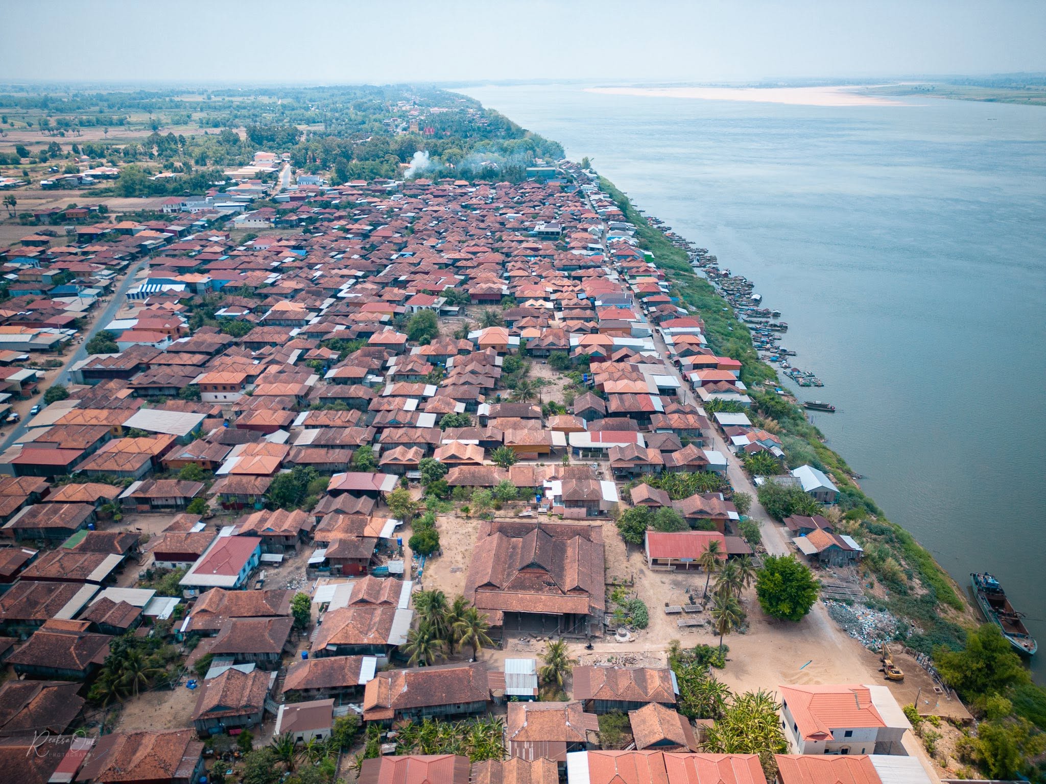
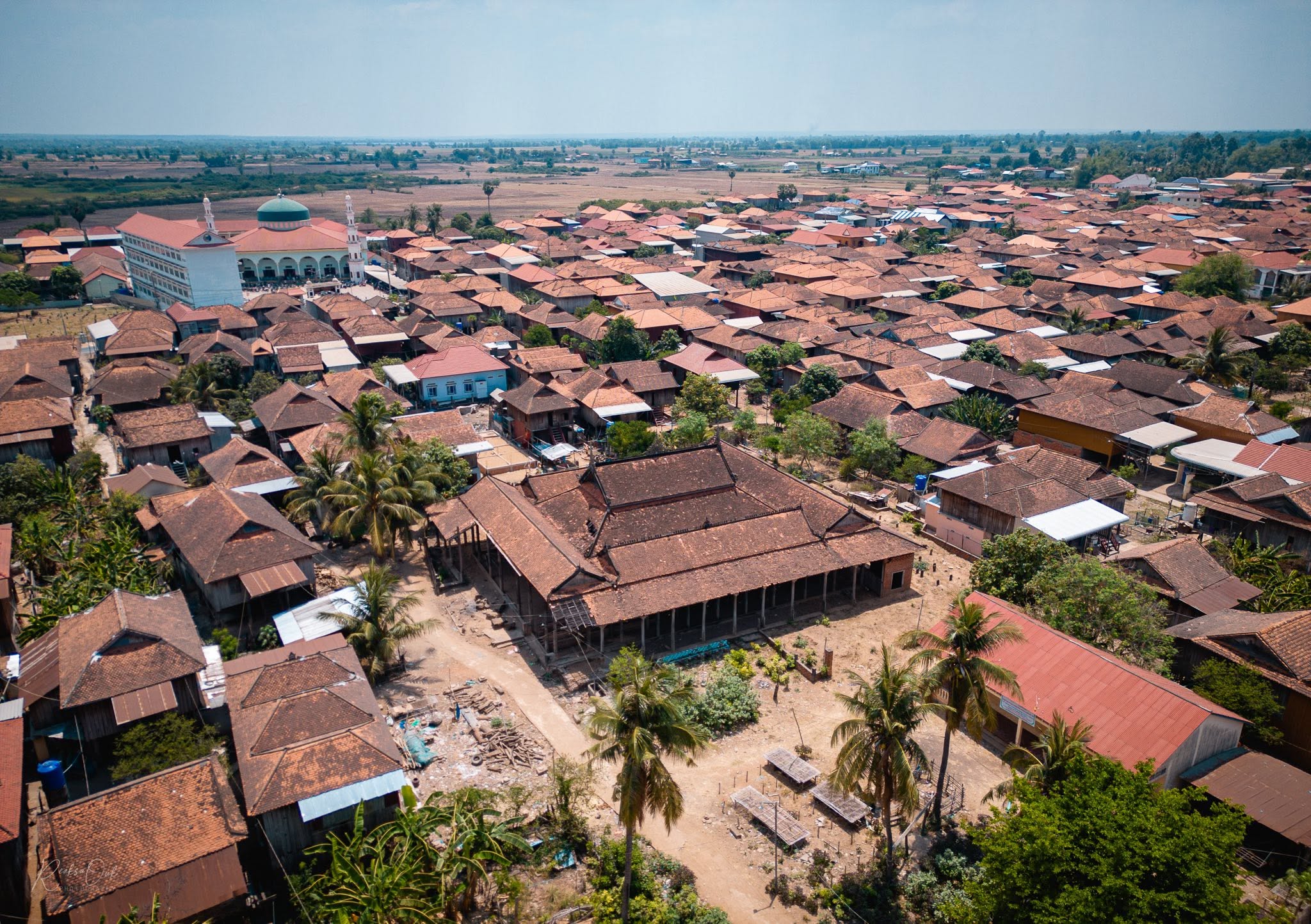
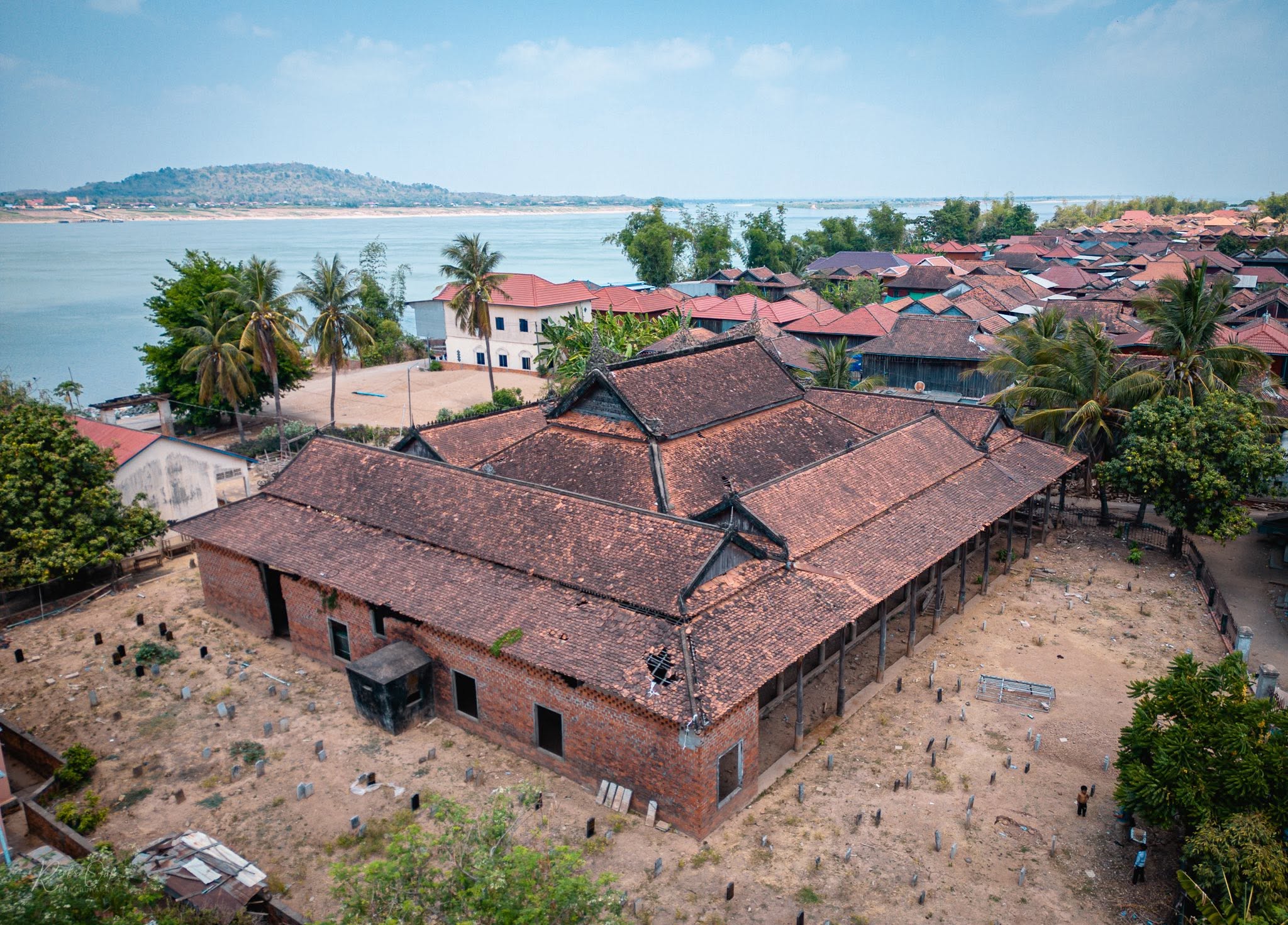
Nowhere is this more visible than in the Jumnik Cham community, located along the Mekong River in Krouch Chhmar District. One of the largest Cham Muslim settlements in Cambodia, the village is known for its remarkable concentration of traditional wooden houses and beautifully crafted wooden mosques, creating a cultural landscape that feels entirely distinct from most other parts of the country. Life in Jumnik remains deeply connected to the river, Islamic traditions, and generations of Cham heritage that have been preserved for centuries.

For travelers interested in cultural tourism, the province offers an opportunity to experience a side of Cambodia that remains largely absent from mainstream travel itineraries – and Jumnik, in particular, offers a rare opportunity to experience the architecture, lifestyle, and spiritual traditions of Cambodia’s Cham population in an authentic rural setting.

Settlement of Cham community at Jumnik. Photos by Cham Culture in Cambodia.

The Land of Tum Teav: Cambodia’s Most Famous Love Story

Tboung Khmum also occupies a special place in Cambodian literature and folklore. The province is closely associated with the legendary tale of Tum and Teav (ទុំទាវ) – Cambodia’s most famous tragic romance. Often compared to Romeo and Juliet, the story follows Tum, a talented poet-monk, and Teav, a young woman promised to another man connected to the royal court. Their doomed love story eventually became one of Cambodia’s most influential literary works and remains widely studied today.

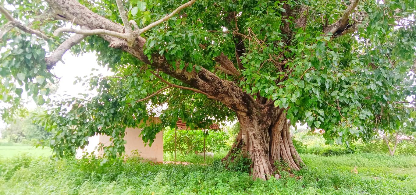
Traveling through the quiet villages and Mekong landscapes of Tboung Khmum, it becomes easier to understand why the story continues to resonate so deeply within Cambodian culture. The province carries a strong sense of memory, tradition, and emotional connection to Cambodia’s rural identity. Today, the Por Cheung Khal (ពោធិ៍ជើងខាល) – a Bodhi tree drawn from the literature of Tum Teav – still stands in Por Cheung Khal village, Muong Riev commune, Tboung Khmum district, welcoming visitors who come to see the living setting of the legend for themselves.

The Red Earth Economy

Modern Tboung Khmum was deeply shaped by the French colonial period, and its economy today still runs on the two crops that period introduced at scale: rubber and tobacco.

The Rise of Rubber Plantations

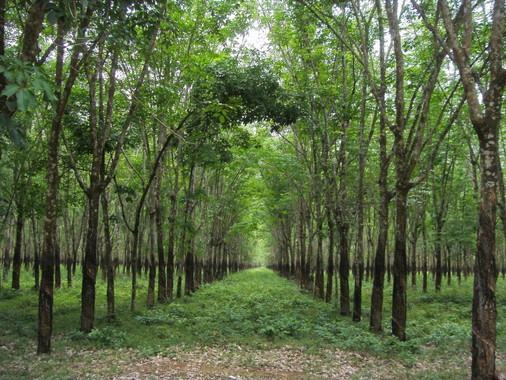
During the early 20th century, French colonial planners recognized the agricultural potential of the province’s fertile basaltic red soil. This led to the creation of large-scale plantations that transformed the economy and landscape of eastern Cambodia. Among the most important developments was the establishment of Chup Rubber Plantation in the 1920s. Today, Chup remains one of Cambodia’s oldest and most historically significant rubber estates, and one of the largest in the entire country – its reach extends across Memot, Ponhea Krek, Tboung Khmum, Tam Bae, and Ou Reang Ov districts.

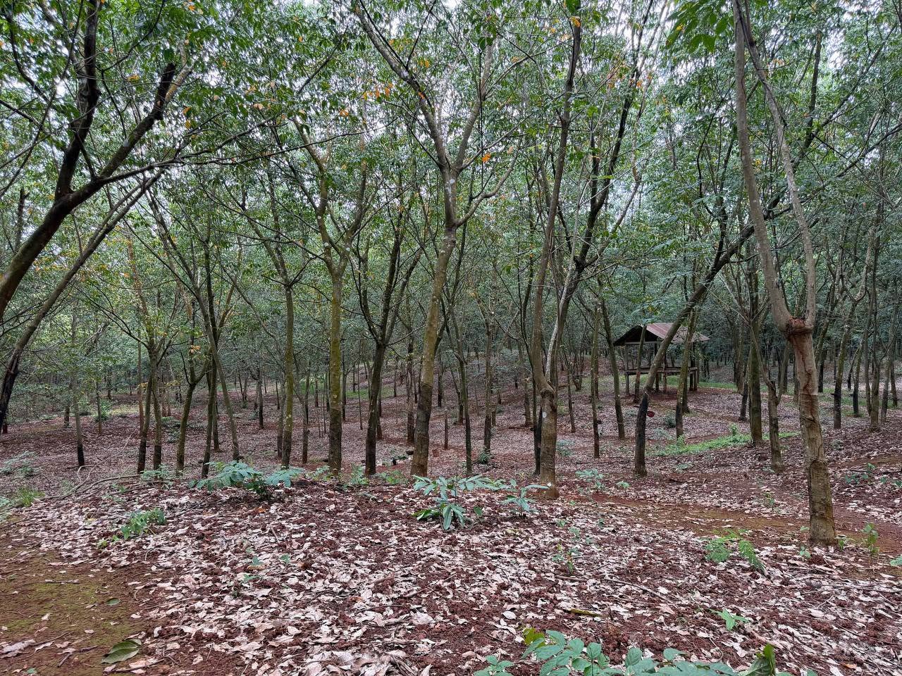
Driving through the plantation feels almost cinematic. Perfectly aligned rows of rubber trees stretch endlessly into the distance beneath filtered sunlight, forming what many visitors describe as green “tunnels” that run for miles. White latex bowls hang from carefully cut trunks, while morning mist drifts through the plantation roads. Early risers who arrive before 10am can watch workers tapping the trees directly – a process not unlike tapping for maple syrup, using a scraping instrument to graze the bark until the latex begins to weep, then letting it drip slowly into collecting cups below.

The landscape itself has become one of Tboung Khmum’s defining visual identities. Beyond its scenic beauty, Chup Rubber Plantation played a major role in Cambodia’s economic history. Rubber exports became one of the country’s most valuable colonial industries and later continued to support the national economy for decades. The plantation celebrated its centennial anniversary in 2024, marking more than 100 years of historical significance.

Tobacco, the Mekong, and Rural Life

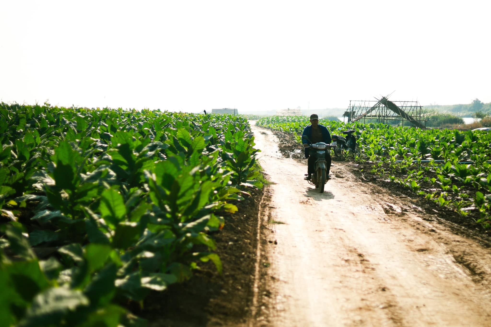
Another defining feature of Tboung Khmum is its tobacco-growing communities along the Mekong River. French colonial influence helped expand tobacco cultivation throughout the region, particularly in Krouch Chhmar and Tboung Khmum districts.

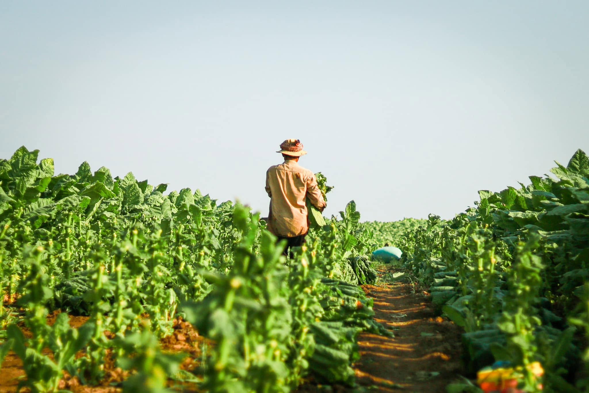
Today, travelers driving through these riverside areas can still witness scenes that feel largely unchanged by modern tourism. Wide tobacco fields stretch across fertile floodplains while traditional wooden curing barns rise beside village roads. During harvest season, the scent of drying tobacco leaves drifts through the countryside as farmers continue techniques passed down through generations.

These agricultural landscapes provide some of the most distinctive rural scenery in Cambodia. Beyond tobacco and rubber, rice paddy farming remains extensive across the province, and the combination of steady rainfall, productive basaltic soils, and reliable access to the Mekong has made Tboung Khmum one of Cambodia’s genuine agricultural powerhouses – supporting thousands of farming households and contributing significantly to the country’s food supply.

Nature and Eco-Tourism in Tboung Khmum

Although the province is best known for its history and agriculture, Tboung Khmum also contains natural attractions that remain largely undiscovered by visitor.

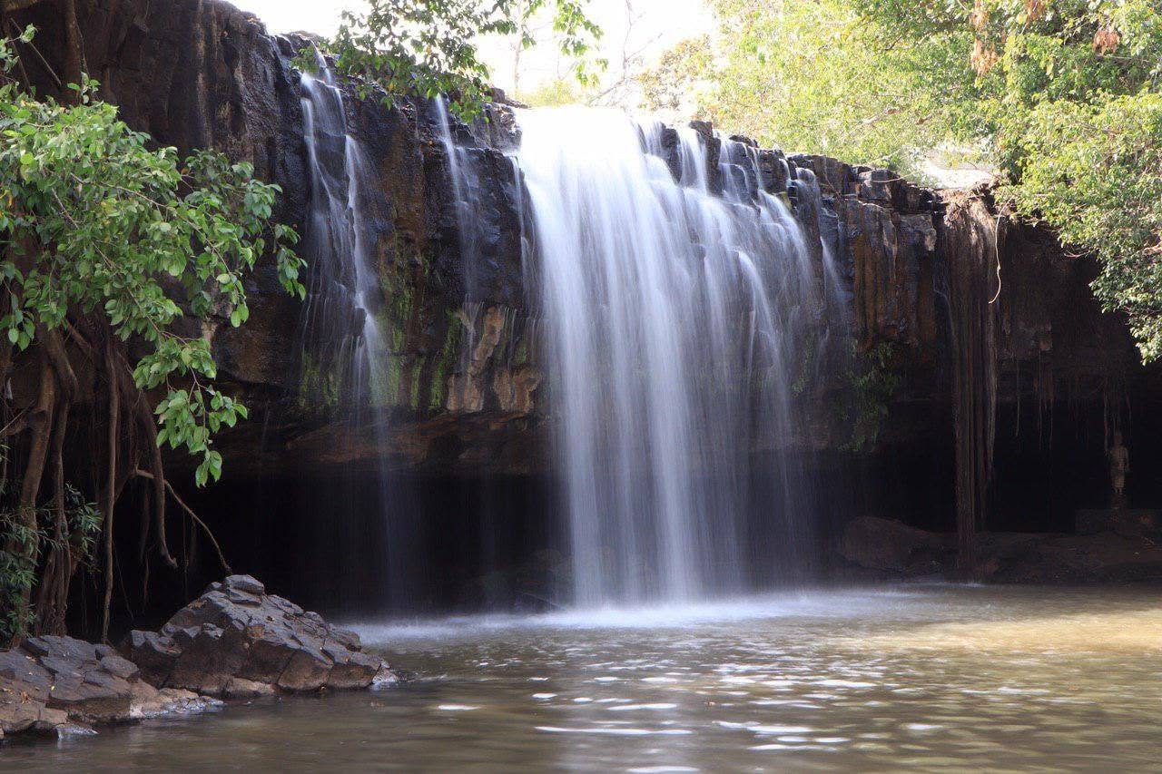
Among the most popular is Haong Waterfall (ទឹកធ្លាក់ហោង), located in Sre Veng village, Teuk Chrov commune, Tam Bae district, roughly 57 kilometers from Tboung Khmum town via National Road 7. Surrounded by greenery, the waterfall cascades over rocky, cliff-like formations into cool pools below, with the surrounding terrain offering a genuine hiking experience rather than a simple roadside stop. During the rainy season, the surrounding forest becomes especially lush, attracting local visitors seeking relief from the heat – though the same rains that feed the falls can also leave the access road muddy, so a visit timed for June to October rewards travelers with the best water flow in exchange for a slightly rougher approach.

An Annual Event Worth Planning Around: The Trapiang Krorm Fishing Ceremony

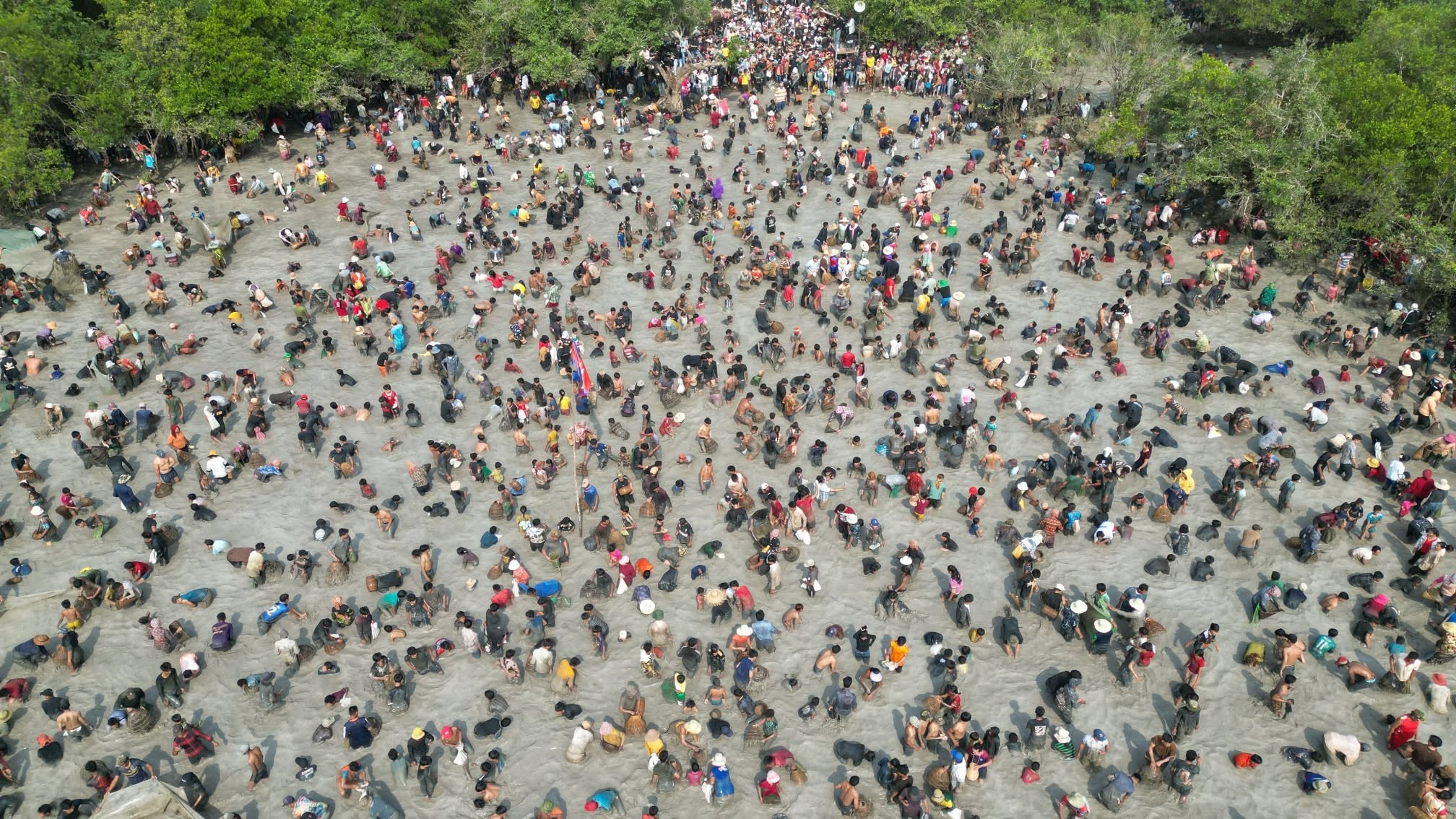
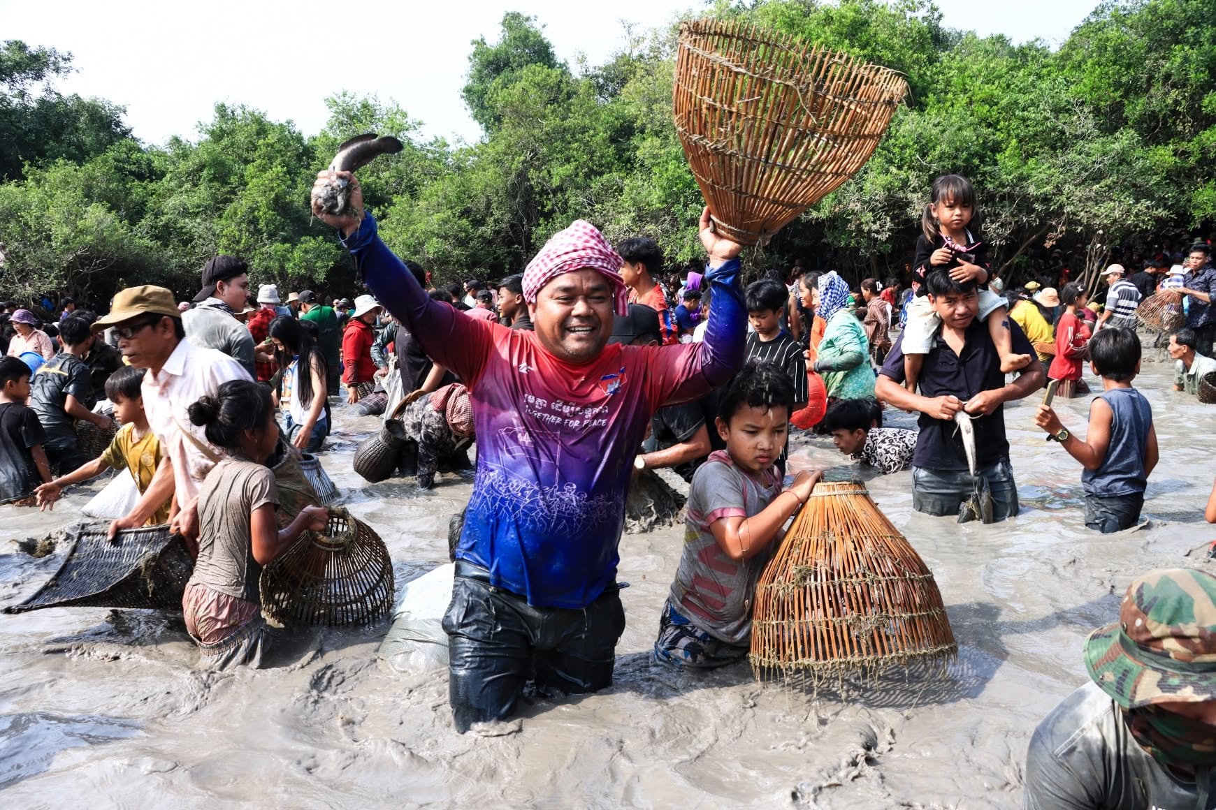
Every February, the small community of Satum village gathers at Trapiang Krorm Lake for a tradition over 200 years old: the traditional fishing ceremony (ពិធីចាប់ត្រីបែបបុរាណក្នុងបឹងត្រពាំងក្រម). Held after the December-January harvest, the four-day festival starts with dancing, singing, and games; on the fourth day, the whole village fishes together using only traditional gear – woven bamboo traps like the angrut (អង្រុត), chhneang (ឈ្នាង), trork (ត្រោក), truu (ទ្រូ), lorb (លប), and chhnok (ឆ្នុក) – and shares the catch. The ceremony runs from around February each year at Trapiang Krorm (ត្រពាំងក្រម), a 3-hectare natural lake in Choam Kravien commune, Memot district.

Tboung Khmum remains one of Cambodia’s most overlooked provinces internationally. Yet few places in the country contain such a rich combination of prehistoric archaeology, early Khmer history, Cham cultural heritage, colonial landscapes, and living agricultural traditions.

Its importance extends far beyond tourism. The prehistoric earthworks of the Memot region are among Southeast Asia’s most significant archaeological landscapes. The province’s early temples help tell the story of how Khmer civilization developed before Angkor. Its Cham communities preserve centuries of cultural exchange along the Mekong River. Meanwhile, its rubber plantations and tobacco farms reveal the economic transformations that shaped modern Cambodia.

At a time when many travelers increasingly seek authentic and meaningful experiences, Tboung Khmum possesses enormous tourism potential. Its strength lies not in luxury resorts or mass entertainment, but in authenticity. Here, Cambodia’s history remains embedded in everyday life – in the soil, the temples, the plantations, the villages, and the river communities that continue to shape the province today.

What to Visit?

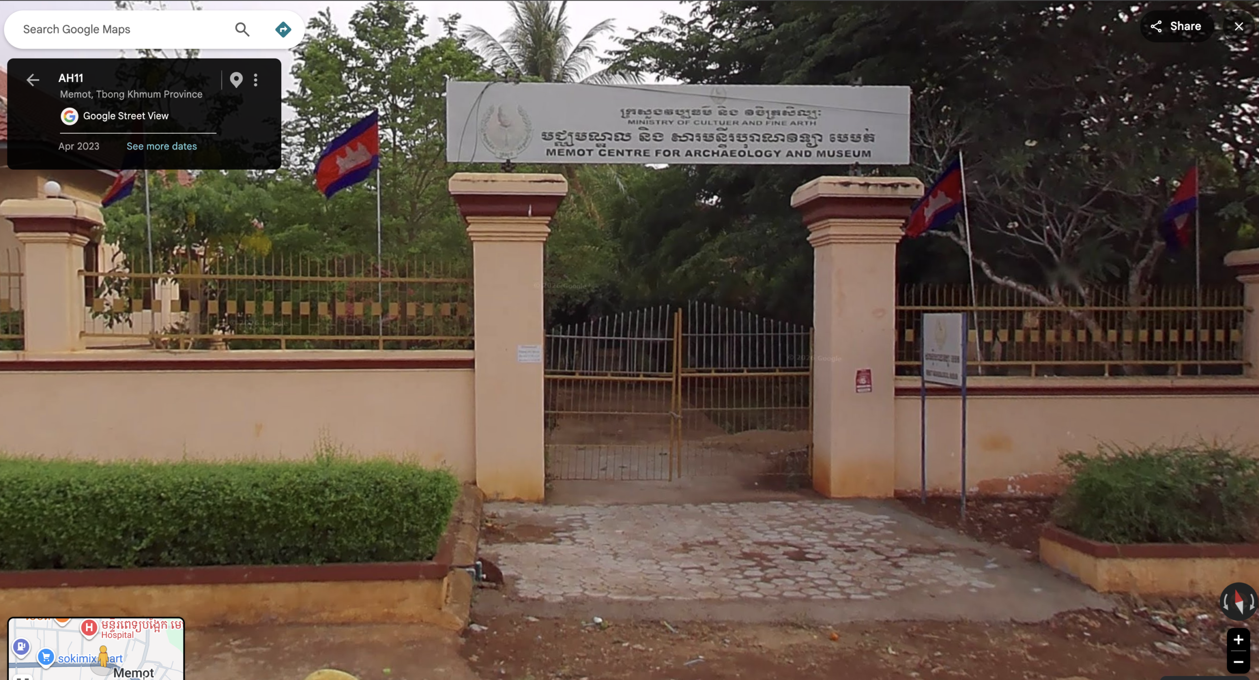
Memot Centre for Archaeology and Museum

  • Location: Near Memot District Hall, Memot District
  • Entrance Fee: Free / small donation

The best introduction to the prehistoric history of eastern Cambodia. Officially opened in 2002 with support from Germany's Heinrich-Boll-Foundation, the museum displays artifacts excavated from ancient earthwork sites throughout the Memot region, including stone tools, pottery, and jewelry dating back nearly 2,000 years.
Banteay Kou Earthworks

  • Location: Memot District (exact sites approximated to district/village level)
  • Entrance Fee: Free (local guide recommended)

Among Cambodia's most important prehistoric archaeological sites and the clearest examples of the region's circular "round village" earthwork culture, of which many examples survive scattered across Memot District. Because most sit within private plantation land and are only loosely mapped, arranging a local guide is strongly advised for anyone hoping to visit in person.
Prasat Preah Theat Ba Srei

  • Location: Preah Theat commune, Ou Reang Ov district, about 43km south of Tboung Khmum town via National Road 11
  • Entrance Fee: Free

An ancient spiritual site blending early Khmer history with modern Buddhist worship - laterite ruines from the Chenla period standing beside a more modern pagoda, famous for its Preah Theat sacred relic stupa.
Preah Theat Thom

  • Location: Ponhea Kraek District
  • Entrance Fee: Free

A major pre-Angkorian temple connected to the rise of the early Khmer kings, with a southern tower dating to the 7th century and later additions linked to Jayavarman II, founder of the Khmer Empire.

Banteay Prey Nokor

  • Location: Ponhea Kraek District
  • Entrance Fee: Free

The historic stronghold associated with King Preah Sdach Kan, featuring moats, earthen walls, brick ruins, and peaceful countryside landscapes - built atop the already ancient Prasat Preah Theat Toch and Thom, sacred ground in use since the 7th to 9th centuries.
Prasat Prey Ky

  • Location: Ponhea Kraek District, Northeast of the Banteay Prey Nokor site
  • Entrance Fee: Free

A quiet pre-Angkorian brick sanctuary, predating the site's later fame as a refuge of King Sdach Kân, known for its isolated atmosphere and weathered architecture.

Prasat Cheung Ang

  • Location: Ponhea Kraek District, Northeast of the Banteay Prey Nokor site
  • Entrance Fee: Free

A hidden pre-Angkorian temple site surrounded by farmland that reflects the province's deep pre-Angkorian heritage, older than the site's later association with King Sdach Kân.

Luong Preah Sdach Kan

  • Location: Norkor Khnong village, Dountei commune, Ponhea Kraek district, about 16.5km from Suong City via National Road 7
  • Entrance Fee: Free

A cultural-historical site within the grounds of Prey Ang Sdach Kan pagoda, marked by a statue of King Sdach Kan mounted on horseback with his bow, commemorating the commoner-turned-king who briefly seized Cambodia's throne in the early 16th century.

Por Cheung Khal

  • Location: Por Chheung Khal village, Muong Riev commune, Tboung Khmum district
  • Entrance Fee: Free

A Bodhi tree (ពោធិ៍ជើងខាល) drawn from the literature of Tum Teav, still standing today to welcome visitors to the living setting of Cambodia's most famous tragic love story.

Jumnik Cham Community

  • Location: Along the Mekong River, Krouch Chhmar District
  • Entrance Fee: Free

One of the largest Cham Muslim settlements in Cambodia, known for its remarkable concentration of traditional wooden houses and beautifully crafted wooden mosques. Life in the village remains deeply connected to the river, Islamic traditions, and generations of Cham heritage - a rare opportunity to experience the architecture, lifestyle, and spiritual traditions of Cambodia's Cham population in an authentic rural setting.
Chup Rubber Plantation

  • Location: Along National Highway 7, spanning Memot, Ponhea Krek, Tboung Khmum, Tam Bae, and Ou Reang Ov districts
  • Entrance Fee: Around $1

One of Cambodia's oldest rubber estates and among the province's most iconic landscapes, best explored by bicycle or motorbike. Arrive before 10am to watch tappers at work, and note that access to the processing plant itself is sometimes restricted by on-site guards.
Mekong Tobacco Farms

  • Location: Krouch Chhmar and Tboung Khmum districts, along the Mekong floodplains
  • Entrance Fee: Free

Traditional tobacco-growing communities and curing barns along the Mekong, best visited during harvest season for the full sensory experience of the drying leaves.

Haong Waterfall

  • Location: Sre Veng village, Teuk Chrov commune, Tam Bae district, about 57km from Tboung Khmum town via National Road 7
  • Entrance Fee: Free

A scenic natural retreat surrounded by forest and rocky, cliff-like terrain. Best visited in the rainy season (June-October) for water flow, though the access road can be muddy during this period.

Trapiang Krorm Fishing Ceremony

  • Location: Satum village, Choam Kravien commune, Memot district
  • When: Around February each year
  • Entrance Fee: Free

A 200-year-old tradition where Satum village gathers at the 3-hectare Trapiang Krorm Lake to thank the gods of earth and water for the season's rain - three nights of dancing, singing, and games, followed by a final day of communal fishing using only traditional bamboo traps. Worth timing a visit around if you want to see a genuinely local celebration rather than a tourist show.

Media credit: Tboung Khmum Provincial Administration, Department of Tourism, Department of Culture and Fine Arts, Ministry of Environment, AMS, BeyondAngkor.org, Kampucheers, Cham Culture in Cambodia, Roza Tob, and others referenced in media description.